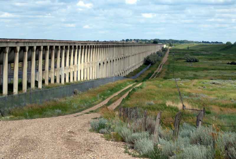
At Brooks Aqueduct, noticing damage is only the beginning. Along a concrete structure stretching more than three kilometres, someone must also record where it is—and leave information that the next person can find.
A University of Calgary heritage project approached that problem with a digital counterpart to the aqueduct. Its mobile recording system was designed to place observations of damage on a virtual version of the structure, rather than leave them as disconnected notes. The old water carrier had acquired another kind of network. [1]
Where is this place?
Brooks Aqueduct area, Alberta — geographic context, not access instructions. This map locates the town or region, not a verified exact historic event site.
Water above the prairie, water below the railway
The Canadian Pacific Railway built the aqueduct between 1912 and 1914 to carry irrigation water east from Lake Newell. Its suspended concrete channel crossed a shallow valley near Brooks, Alberta. Where the railway interrupted its path, an inverted siphon took the water underneath the tracks. [2]
This was infrastructure for a particular business as well as a farming region. Alberta’s heritage register connects the railway’s irrigation works with its effort to attract agricultural settlement to land it owned. The Eastern Irrigation District took over the aqueduct in 1935. A replacement canal brought its water-carrying career to an end in 1979. [2][3]
Ending the flow did not end the work. ISL, an engineering firm involved in its conservation, describes cracking and loss of surface concrete in columns and crossbeams within the wetlands beneath it. The firm says an environmental assessment in 2018 helped establish how repairs could be undertaken there. Conserving the structure also meant considering the ground and habitat around its supports. [4]
A record that could be revisited
The university’s 2017 campaign combined ground-based laser scanning with aerial photography. One method failed: camera problems prevented an airborne laser survey from capturing data. A truck-mounted scanner substituted, recording three sides of the aqueduct. [1]
A digital model, then, has its own history of access, equipment and missing views.
The project described a baseline for later comparisons, with searchable records connecting damage to locations. This was a way to ask what had changed, not a declaration that deterioration had stopped—or proof that every proposed annual resurvey later happened. [1]
People behind the points
The work also depended on people looking closely. In a report on a 2019 archaeological tour, researcher Christina Robinson wrote that she had recently completed aqueduct fieldwork with support from the Archaeological Society of Alberta’s Calgary Centre and volunteers from across the province. She guided the visiting group through the structure’s history, damage and preservation work. [5]
That account makes the project less abstract: a place familiar as a long line of concrete was also a field site, a volunteer undertaking and a subject for conversation.
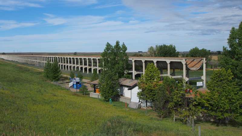
The photographs here, taken in 2010 and 2014, predate the digital campaign. They show the aqueduct’s repeating supports and exposed channel end, not a survey result or a current condition assessment.
The aqueduct no longer carries irrigation water. Keeping a useful record of it means giving each observation a place to belong—and leaving enough context for someone else to return.