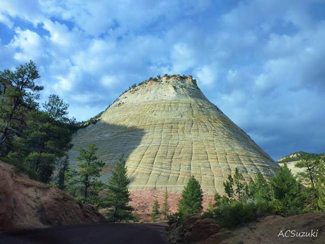
The lines crossing Checkerboard Mesa did not all begin as cracks. Its near-horizontal bands follow bedding in the Navajo Sandstone; the upright lines cut across that bedding. A US Geological Survey photograph records the two sets meeting at roughly right angles above a foreground of pinyon, juniper and ponderosa pine. [1]
The sandstone began as sand. In its teaching guide for Zion National Park, the National Park Service describes shifting winds building dunes across a vast desert. Those dunes left cross-bedding—the layered patterns still visible in the rock. Later, weathering picked out the bands on Checkerboard Mesa’s surface. [2]
Where is this place?
Checkerboard Mesa, Zion National Park, Utah. This map locates the town or region, not a verified exact historic event site.
Turning loose sand into that rock required another process. Mineral-bearing water filtered through buried, compacted sediments, depositing cementing materials. Zion’s geology account names iron oxide, calcium carbonate and silica among the agents that bound its sediments together. [3]
The upright cracks have a different explanation. The teaching guide attributes them, cautiously, to repeated freezing and thawing at the rock surface. [2]
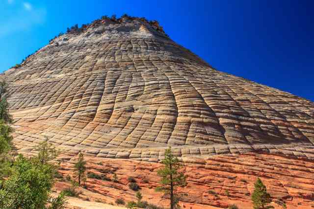
Larger fractures also shape the scene. The straight north–south canyons beside Checkerboard Mesa follow major breaks in the sandstone. The guide distinguishes those canyon-controlling fractures from the younger pattern across the mesa’s face. [2]