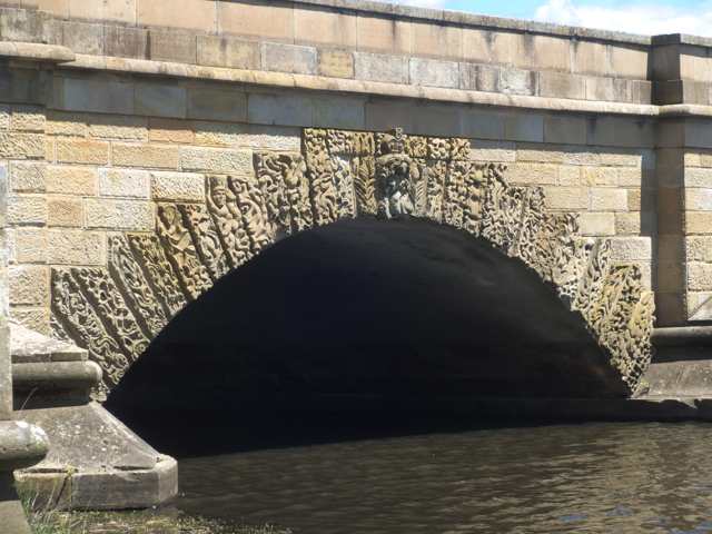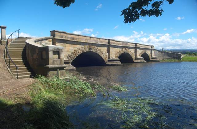
Seven of the carved stones around Ross Bridge’s north-eastern arch needed an addition. Their lengths had been underestimated, archaeologist Maureen Byrne explained in her 1976 study: small extra blocks completed the work. Her photograph’s caption directs attention to the middle seven stones, where the extra pieces were fitted. [1]
The bridge carries its ornament right around the arches. On each face, 31 carved arch-stones—voussoirs—follow each of the three curves, making 186 carvings altogether. Faces and animals interrupt the ornamental patterns. Above them, inscriptions record the 1836 completion date and the names of Governor George Arthur and construction superintendent Captain William Turner. The structure crosses Tasmania’s Macquarie River at Ross, with curved stone stairways descending at its corners. [2]
Where is this place?
Ross Bridge, Tasmania. This map locates the town or region, not a verified exact historic event site.
Stone close at hand
Obtaining sandstone had changed the building arrangements before the bridge was finished. In September 1835, Turner cancelled a request for replacement bullocks to haul stone. A deposit had been found close to the new bridge’s eastern pier, according to the correspondence cited in the Tasmanian Heritage Register. The register suggests that this was near today’s car park; it does not establish that location conclusively. [2]
Byrne’s later investigation recorded how the builders used stone once it reached the bridge. Working alongside a road-reconstruction project, she and her colleague Gwen Eva drew, measured and excavated. Some dressed blocks had broken or developed flaws during preparation. Rather than discarding them, the builders placed them in lower courses where the finished bridge concealed them. Byrne’s plate 11 records one such block, with a trowel providing scale. [1]
The seven short arch-stones presented a different problem: their decorated faces would remain exposed. Byrne’s plate 13 identifies the smaller pieces made to complete them. The current heritage description still points readers to that same group on the northern side nearest the eastern bank. [1][2]