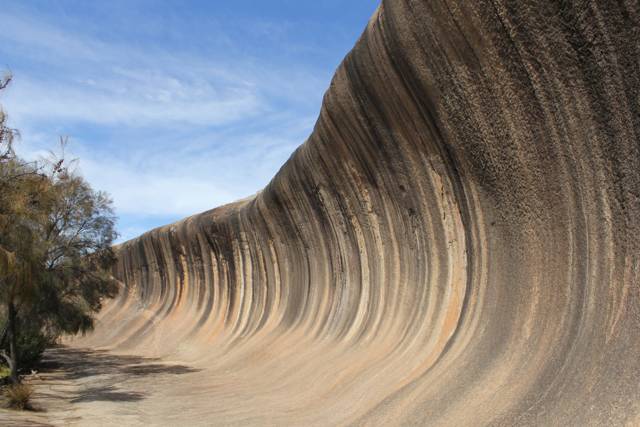
The curve is natural; the low wall above it is not. At Wave Rock, near Hyden in Western Australia, a granite face curls outward like a wave about to break. A concrete-and-masonry catchment wall redirects rainfall towards a reservoir. That addition makes the familiar view harder to divide into scenery and engineering: water helped shape the rock, and people later intercepted some of its flow. [1][4]
The Australian Museum identifies Wave Rock as the northern face of the larger Hyden Rock outcrop. Weathering and water erosion undercut the base, leaving its rounded overhang. Water also carries dissolved material down the face, depositing coloured stains. Those processes explain why runoff matters to the formation's appearance; they do not, by themselves, establish the cause of every dark streak in a photograph. [1]
Where is this place?
Wave Rock, Hyden, Western Australia — geological and waterworks context, not access or safety guidance. This map locates the town or region, not a verified exact historic event site.
Hyden's municipal heritage record gives the waterworks a history separate from the famous curve. It links the town's settlement to water running off the rock, records a small weir by 1929, and says the dam was roofed in 1936 using government sustenance labour. Enlargement followed in 1951, then a reticulated town supply in 1952. These are stages in a supply system, not dates for the formation of the wave—or proof that every wall visible today was built at the same time. [2]
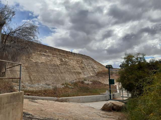
That system's later story could easily be misread as a retirement notice. In a 2023 ABC report, Water Corporation anticipated that planned 2025 scheme upgrades would probably remove the reservoir's collection role. But its statement also left open retaining it for non-potable irrigation. The prediction was conditional, not a completed demolition. In July 2026, ABC reported that drinking-water use had ended, while the corporation described the reservoir as still important for non-potable supply, supporting farming and reducing demand on scheme water. [3][4]
Keeping it was not an uncontested choice. In that later report, Noongar man and Hyden local Michael Ward argued for removing the catchment wall, at least temporarily, believing it had changed the rock's colours. Shire president Kent Mouritz defended its water-supply role, particularly for firefighting. An August update added another distinction: Curtin geologist Katy Evans thought the black staining most likely a biofilm rather than tar, while suggesting the wall could have helped create favourable conditions for its growth. That is a qualified explanation, not a chemical test supplied by these photographs. [4]
The wall therefore cannot be understood simply as an abandoned utility interrupting an untouched view. The historical dam, the present catchment debate and the streaked cliff describe different parts of the same place. Ending one use of its water did not end the argument about where that water should go.