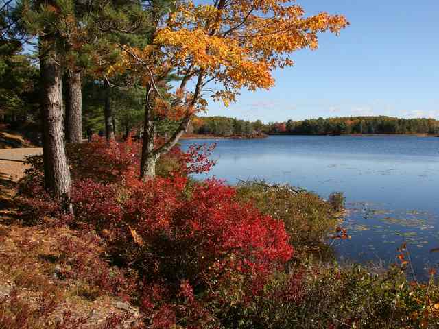
When a gravel road washes out, the obvious place to look is the ground. At Acadia National Park, road crews also looked up. Branches hanging over the historic carriage roads were gathering rain and delivering it to particular spots, where small channels could grow into washouts.
That is how Keith Johnston, the park’s chief of facility maintenance and operations, described the problem in a September 2026 interview published by Friends of Acadia. Cutting the canopy back, he reported, helped the roads dry and reduced the loss of surface stone. It is a small but revealing detail in a landscape celebrated for making roads fit among the trees. [1]
Where is this place?
Acadia National Park carriage-road network, Mount Desert Island, Maine — general public setting, not an exact historic washout or camera location. This map locates the town or region, not a verified exact historic event site.
The scenery has a cross-section
John D. Rockefeller Jr.’s carriage-road construction on Mount Desert Island ran from 1913 to 1940. The roads followed hillsides rather than simply flattening them. Retaining walls helped preserve slopes and trees; landscape architect Beatrix Farrand advised on planting that framed views and softened construction scars. The natural-looking setting was carefully arranged. [2]
The road itself was arranged just as deliberately. Its surface rises in the middle: a crown that sends water toward the edges. Below it, successively larger stone forms the roadbed. Ditches and culverts carry runoff away. The visible gravel is the top of a system, not its whole substance. [2]
That distinction becomes especially clear when some of the road leaves its assigned place.
When the surface reached the woods
On 9 June 2021, an intense rainstorm damaged Acadia’s carriage roads and neighboring terrain. The National Park Service subsequently described hundreds of tons of road-surface material being swept into the woods. The account recorded deep washouts as well as gravel deposited beyond the roadway. The damage was not confined to a rougher ride. [3]
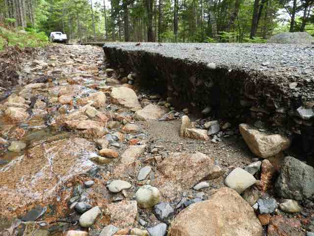
Water also stripped vegetation and soil from around tree roots. The park’s account explained that forest canopy normally cushions rainfall reaching the ground, but this storm overwhelmed the protection. Repair therefore involved a historic transportation system and the living landscape around it—not simply filling holes where wheels would pass. [3]
This does not mean that overhanging branches caused the 2021 storm damage. Nor does the canopy discussion suggest that trees generally make erosion worse. The two accounts describe different settings: soil beneath a forest and a constructed road whose surface needs to shed water along particular paths.
Keeping a road in shape
Johnston’s 2026 explanation separates routine care from major rebuilding. Regular work replaces the uppermost layer of fine stone. A larger rehabilitation removes two upper layers, restores the crown and ditching, resets roadside stones, then replaces the removed layers. His account of canopy management belongs within that continuing work, rather than presenting trimming as a cure for every washout. [1]
The 2021 recovery account likewise describes crews re-forming the road’s crown. A broad, fairly smooth surface can conceal a carefully maintained slope; losing that shape changes where rain travels. [3]
Acadia’s carriage roads offer an unusually legible lesson in how a scenic place is made. The work is not only in the handsome bridges or the boulders at the edge. It is in the height of the middle, the clear route into a ditch, and sometimes the branch overhead. Looking natural still takes looking after.