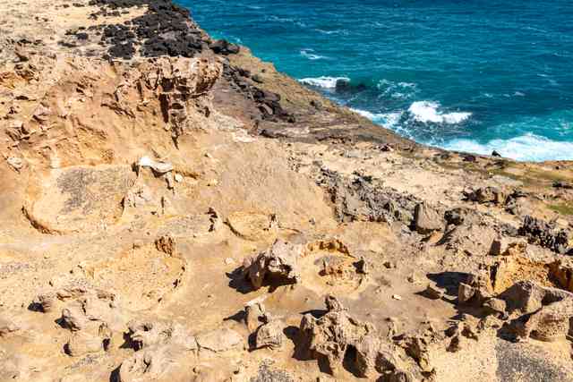
The first things to notice are the holes. In Dietmar Rabich’s 2019 photographs of Cape Bridgewater’s “Petrified Forest”, some formations look like broken stumps; others stand in a close, corrugated row. Yet their rims and hollow centres suggest another way of looking. Instead of asking what once grew here, ask what passed through the rock.
The familiar name belongs to a real disagreement, not merely a tourist’s mistake. In a 2009 account of this part of western Victoria, geologist Ken Grimes contrasted an earlier buried-forest explanation with the interpretation he supported: limestone solution pipes, surrounded by cemented rims. The Portland Tourist Association also presents the formations as solution pipes rather than petrified wood. Changing the explanation does not make the shapes less remarkable. [1][2]
Where is this place?
Petrified Forest, Cape Bridgewater, Victoria — named-site context, not a cliff-edge route. This map locates the town or region, not a verified exact historic event site.
Grimes put them within a larger drainage story. Porous dune limestone lies above older volcanic rocks. In his account, rainwater seeps down through the limestone, dissolving vertical passages, then travels sideways along the boundary with the less permeable rock below. Springs emerge where that boundary meets the cliffs; dissolved lime can be deposited again as tufa terraces. The hollow columns are one part of a landscape in which water both removes and deposits material. [1]
That still leaves a question: why would the passages narrow, swell or develop unevenly rather than form identical straight tubes? A photograph from Cape Bridgewater appears among the natural examples in a study by Karine Petrus and Piotr Szymczak, published in Frontiers in Physics in January 2016. Their tool was a numerical model, not a reconstruction of every column at the cape. [3]
The model starts with feedback. A small difference in the pore structure can focus water flow; dissolution then enlarges the favoured route, attracting more flow. The researchers tested what happens when less porous horizontal layers interrupt the rock. Their simulated pipes narrowed within those layers and widened beyond them. Longer channels could capture flow while shorter ones lost out. Rock that looks repetitive at a distance can therefore contain a record of unequal routes through it. [3]
The authors reported qualitative agreement with natural forms. That is useful evidence about how shapes develop, not a photograph-based measurement of ancient rainfall or a date for each pillar. [3]
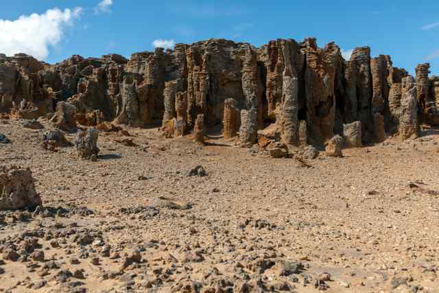
There is a more recent water story at ground level. Reporting a March 2020 excursion, Janeen Samuel and Rod Bird described cut branches placed on denuded clifftop ground to provide cover and slow runoff. They observed vegetation becoming established, including cushion-bush near the lower parts of some pipes. Some in the party regretted that growth. This was a dated field observation, not a controlled restoration trial or a verdict shared by everyone nearby. [4]
The contrast is revealing: the stone “forest” attracts attention partly because its structure is exposed, while living vegetation can obscure that structure as it returns. Neither the old name nor a bare-rock photograph tells the whole story. Cape Bridgewater offers something more interesting than a likeness to trees—a place where the routes of water help explain both the spectacle and the changing ground around it.