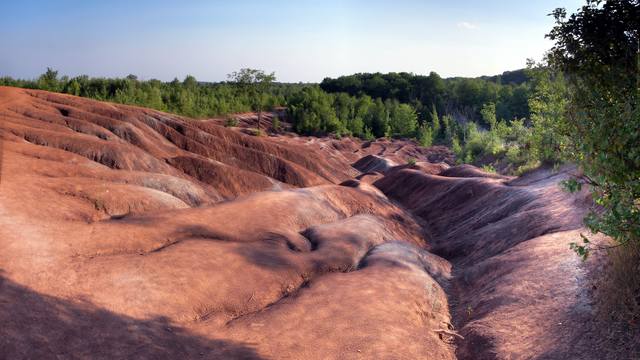
In Ian Muttoo’s photographs of the Cheltenham Badlands, the red ground folds into ridges and gullies against a green wooded edge. The shapes make an absorbing subject. Yet the site’s reopening depended on work well outside the photograph.
The Ontario Heritage Trust announced the Caledon site’s reopening for 22 September 2018 with a viewing boardwalk, marked trails, signs and parking. Its release looked back to a closure in 2015, prompted by erosion of the sensitive shale surface and concerns about public safety. The new arrangement was not a return to unrestricted wandering over the red ground. Visitors were to remain on the boardwalk and marked trails. [1]
Where is this place?
Cheltenham Badlands, Caledon, Ontario — site context, not a current trail or access guide. This map locates the town or region, not a verified exact historic event site.
A different clock appears in a trail volunteer’s account. Writing in the Caledon Hills Bruce Trail Club’s spring 2019 newsletter, quadrant leader David Lloyd dated the closure of the Bruce Trail through the property to around 1 April 2017. Volunteers blocked its three access points and removed signs and visible blazes. Then, through the summers of 2017 and 2018, they continued maintaining the closed main trail so it could reopen promptly. [2]
Lloyd’s September work list turns reopening into a sequence of small tasks. Old boardwalk sections were removed, cut and taken to storage. Signs and turn markers went back up; the trail was re-blazed; its temporary reroute was removed. He estimated 90 hours of volunteer trail-maintenance work for the project—not the labour total for the entire visitor-infrastructure scheme. [2]
Nor does keeping feet off the shale mean that every ridge will hold its shape. In a 2024 Canadian Geophysical Union conference abstract, University of Toronto researcher Joseph Desloges described surveys of the site and the uneven behaviour of its gullies. Some lower-gradient areas were filling and stabilising; steeper gullies were deepening faster than ridge tops. Wetting, drying, cracking and the movement of material remained part of the landscape’s story. This is a research abstract, not a complete study of what changed after reopening. [3]
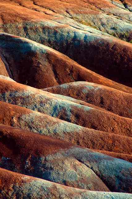
Muttoo’s images predate the closures: the photographer dates the broad view to 2007 and the close-up to 2009. They show the terrain, not the later boardwalk or evidence of a restoration result.
Its reopening depended not just on new viewing infrastructure, but on volunteers who had kept an unused route ready to become a trail again.